La Niña Is Headed for a Rare "Triple Dip" Return — With Big Implications


According to the article below, “A triple-dip La Niña outlook is a warning sign that the drought may be extended yet again.
NOTE: this article was originally published to Axios.com on June 16, 2022. It was written by Andrew Freedman.
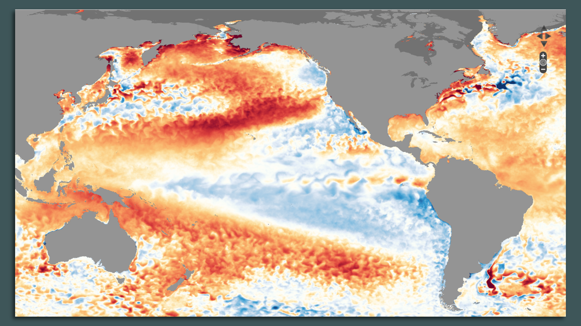
Map of sea surface temperature departures from average across the Pacific Ocean, showing cold anomalies near South America and the equator, a telltale sign of La Niña. Photo: NOAA/NNVL
An ongoing La Niña event in the tropical Pacific Ocean is at near record intensity for this time of year and could extend its streak into a rare third fall and winter season, according to forecasters at the National Oceanic and Atmospheric Administration (NOAA).
Why it matters: La Niña, which is characterized by cooler than average sea surface temperatures in the equatorial Pacific Ocean, has repercussions for the Atlantic hurricane season.
Such events tend to weaken upper-level winds over the Atlantic Ocean, creating more favorable conditions for tropical storms and hurricanes to form and strengthen.
For this reason, most forecasting groups in the public and private sectors are predicting an above-average hurricane season.
The big picture: The current La Niña began back in the late summer and early fall of 2020, and it has reached an intensity that ranks it “among the strongest springtime La Niñas in the historical record dating back to 1950,” according to NOAA’s Michelle L’Heureux, who specializes in El Niño and La Niña.
The latest forecasts call for La Niña to potentially wane this summer and then rebound in the fall and early winter. This would be known as a “triple-dip La Niña,” since it would be the third straight La Niña fall/winter season.
“Most models hint at a La Niña rebound during the fall/winter,” L’Heureux said.
Of note: With each week that La Niña remains, the less likely it becomes that 2022 will set a new global temperature record. The cooler ocean waters in the Pacific tend to keep somewhat of a lid on global average temperatures.
However, the world’s oceans overall are continuing to take up extra heat from an atmosphere altered by human-caused greenhouse gas emissions, ensuring that more heat will be released into the atmosphere as soon as this La Niña ends.
Typically, El Niño events, which feature warmer than average sea surface temperatures in the equatorial Pacific, provide an extra boost to global average temperatures and lead to record warmest years.
May was the ninth-warmest such month on record globally, NOAA found. It would likely have been even warmer without La Niña’s influence.
The agency predicts 2022 is “almost certain” to wind up among the top 10 warmest years. However, it’s currently running in sixth place.
Yes, but: La Niña has still other consequences and is likely exacerbating the drought in the Southwest.
A triple-dip La Niña outlook is a warning sign that the drought may be extended yet again.