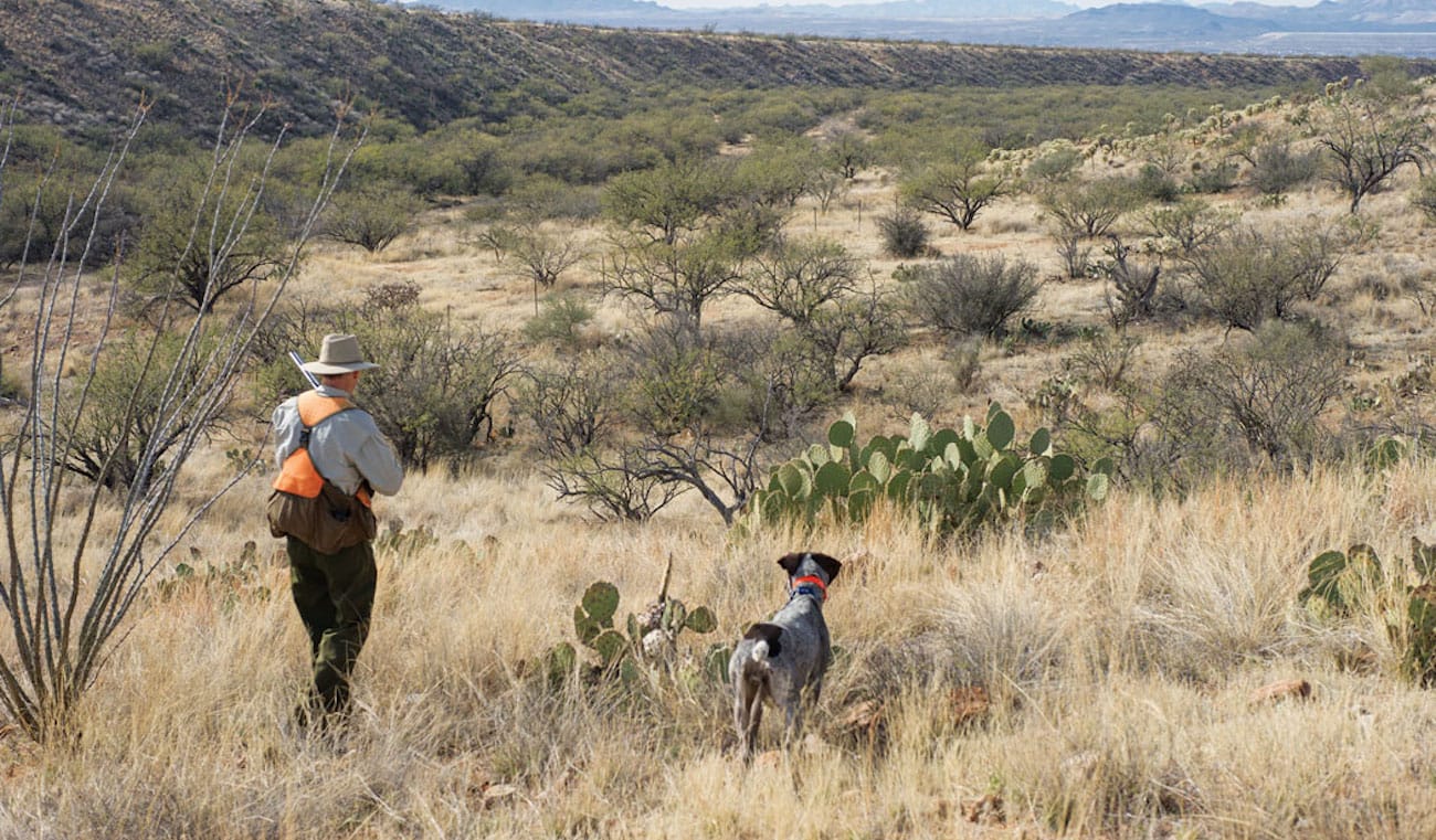
Arizona's Gambel's Country

Far-West Texas is the Eastern limit of this amazing and beautiful gamebird.
Gambel’s Quail need brushy habitat which gets grazed. So landowners considering brush and cattle removals should understand this: No brush, no cows, no Gambel’s.
NOTE: this article initially appeared on ShootingSportsman.com It was written by our good friend, E.Donnall Thomas (MD). The feature image (above) is from the article, and was taken by his wife, Lori Thomas.
Arizona has plenty to offer visiting upland hunters, including generous seasons, abundant public land and three species of quail.
Because Gambel’s quail are the most abundant, widely distributed and accessible of the lot, it is worth exploring the opportunities for them. Hunters looking for birds in unfamiliar territory need to address two considerations. First: What defines the species’ preferred habitat? And second: Where can such cover be found and how accessible is it?
Gambel’s quail are well adapted to the desert environment. While they can survive on moisture from succulent plants, they will utilize surface water when it’s available. In contrast to mountain-dwelling Mearns, they inhabit the desert floor. I hunt them in rolling foothill terrain interlaced by dry washes, which provide easy walking for hunters and support thicker brush than open desert, creating better security habitat. Mesquite and prickly-pear cactus are both reliable indicators of Gambel’s habitat.
While the species’ range extends from Southern California to West Texas and from Mexico to parts of Utah and Colorado, the heart of the population lies in southern Arizona. This area contains plenty of prime habitat, the majority of it on public land. The swath extending a hundred miles on either side of US Highway 10 is all prime country, with hunting more productive to the east. The towns of Oracle and Safford make good bases of operation.
The Bureau of Land Management oversees 12 million acres in Arizona, including a lot of great quail cover. BLM maps show land ownership clearly, but I find BLM websites difficult to navigate. Good information is available from the BLM Gila District office, Safford Field Office and the Public Lands Information Center.
The US Forest Service manages the isolated “Sky Island” mountain ranges, where foothills offer good Gambel’s hunting. USFS maps are often better at showing backroads and terrain features than BLM maps. For information, contact the Coronado National Forest. Look for the maps of these districts: Nogales, Sierra Vista, Santa Catalina Safford and Douglas.
Parcels of state land lie scattered throughout the area and are readily identified on BLM maps. The Arizona Dept. of Game and Fish (AZDGF) also administers an Access Program that works with landowners to allow access to parcels “landlocked” by surrounding private property. For more information, contact Al Eiden at the AZDGF.
Two large reservations in eastern Arizona offer good quail hunting. In some areas hunters must be accompanied by a local guide but not in others. Contact tribal authorities for current regulation details at the San Carlos Apache Reservation and the White Mountain Apache Reservation.
I have tried to provide an overview of public-land hunting, but the reality on the ground is even simpler. Visiting hunters could spend all season on BLM land and never hunt the same cover twice. The best news is that after an extended drought cycle produced a decade of poor quail numbers, the birds recently have enjoyed good rains and are starting to rebound.
The cover belongs to all of us. Let’s make sure it stays that way.
